Phillip Island: Woolamai

One of the best wavesailing beaches in Victoria, and on the right day – the whole country. Powerful swell magnet beach breaks deliver excellent down the line conditions on E-SE and N-NW winds at any time of year. Woolamai is notorious for heavy waves and strong currents, best left to experienced riders on all but the smallest of swells.
Deep rips run out along the beach at regular intervals and the high swell action sees the sandbanks changing constantly. These rips are helpful to get out through the break, particularly on larger swells or lighter wind days.
Wave quality varies dramatically depending on the sand, usually there will be at least one decent bank in the main sailing area from 2 rips east of the main carpark heading west to the ANZACs carpark. A classic day usually involves a sucky, barrelling peak peeling into a nice shaped wall before tapering off into a rip.
Watch the reef just west of ANZACS which can go dry at lower tides.
Optimal Conditions:
For summer port tack riding, warm temperatures, clear skies, 20+ knots ESE and 4-5ft of swell with mid-high tide. For winter starboard tack riding, howling NNW, 4-5ft of swell with mid-high tide.
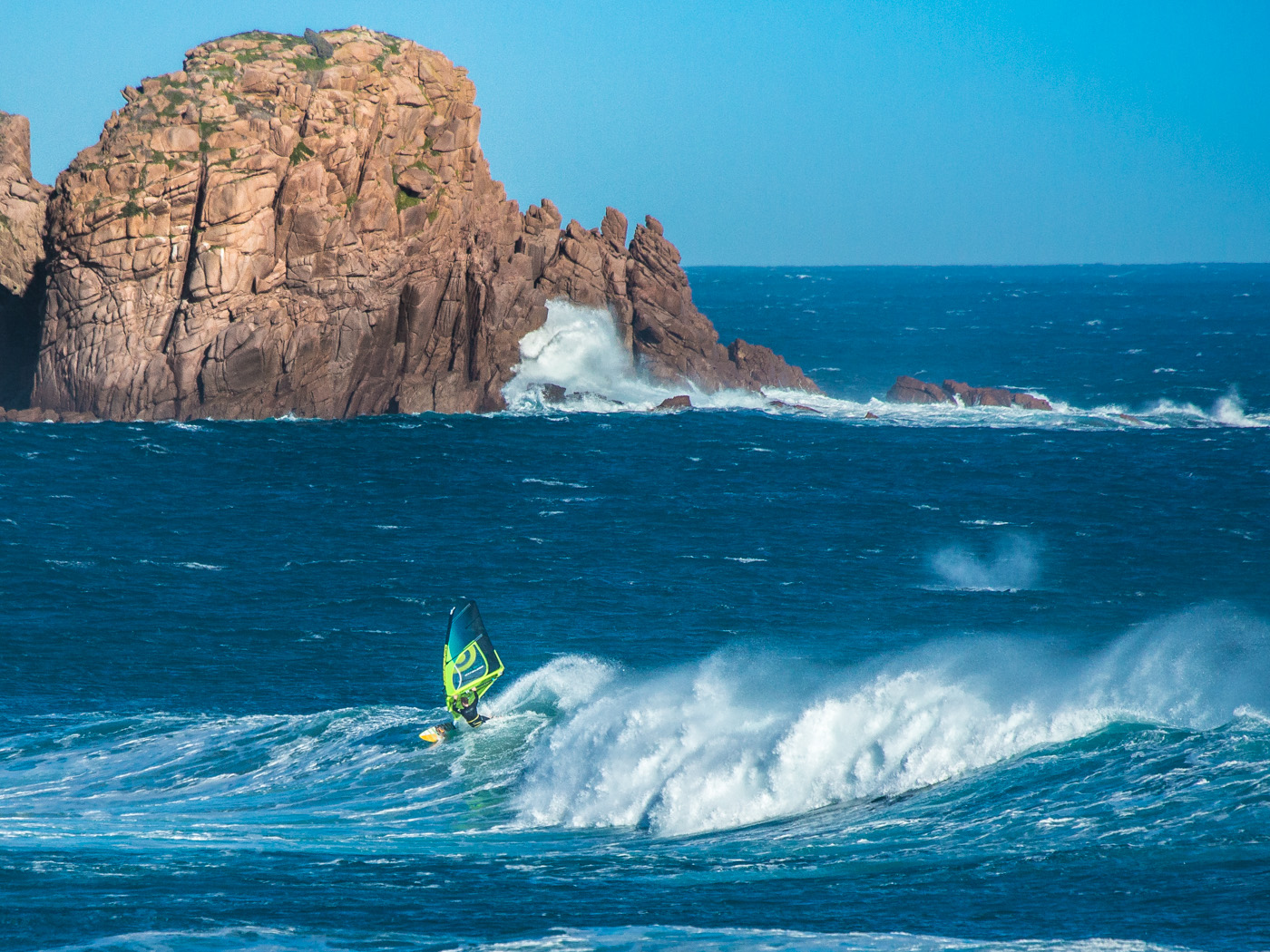
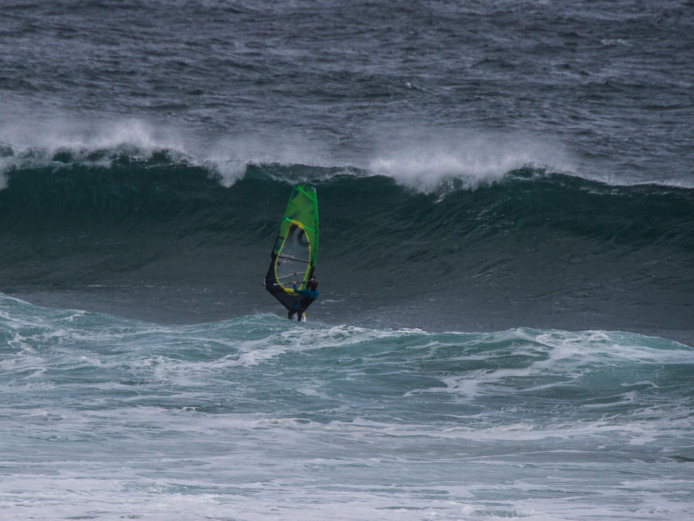
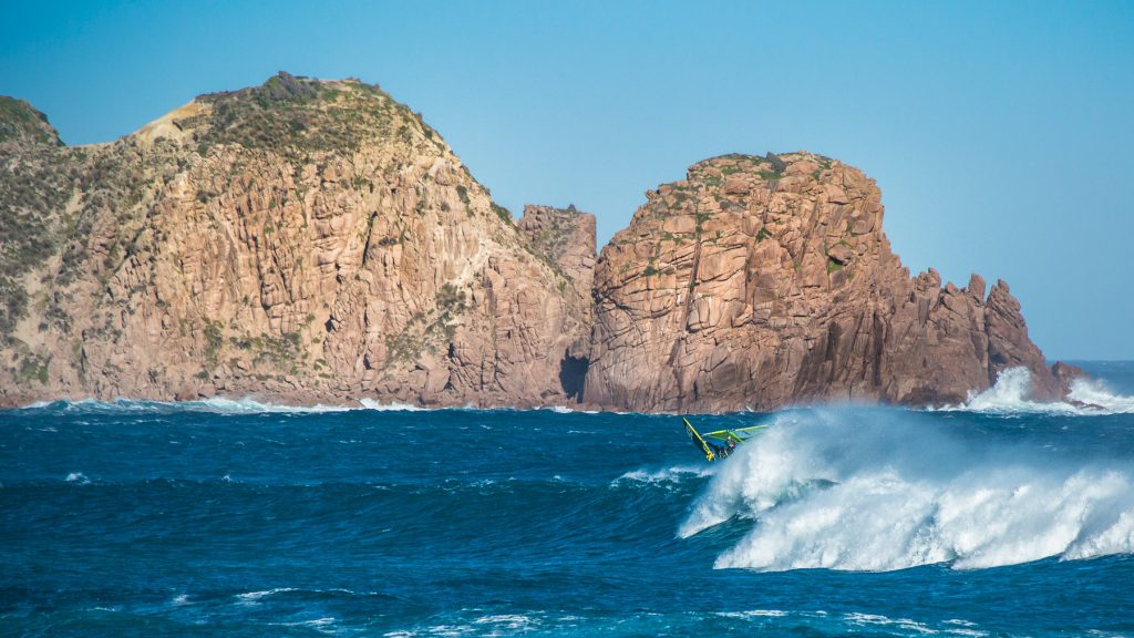
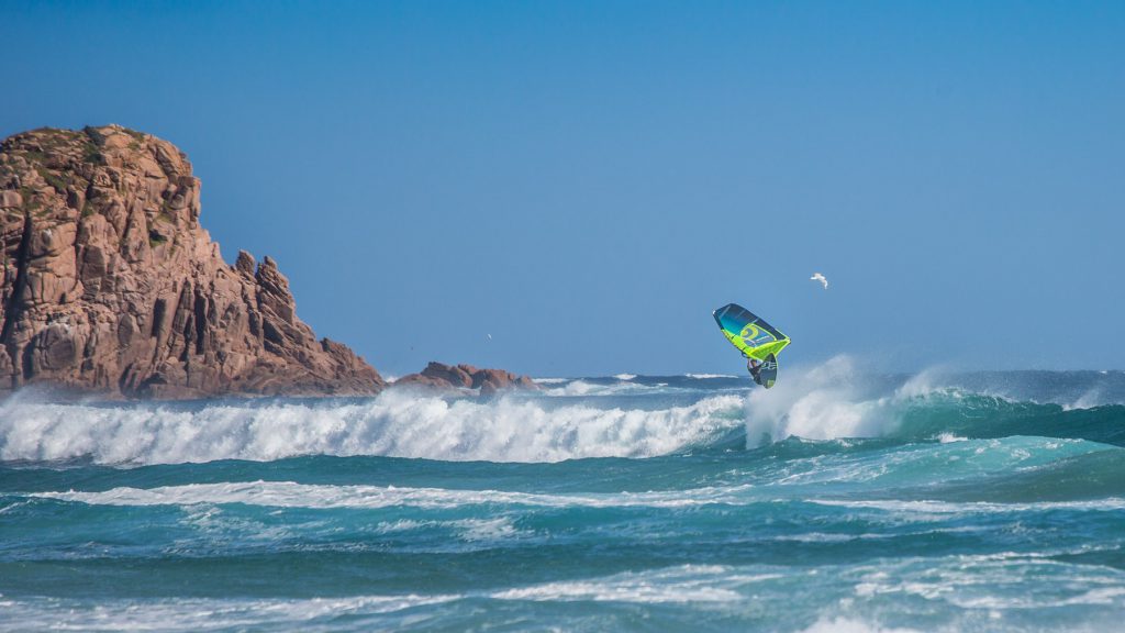
Above: A classic winter session at Woolamai, 3-5ft waves, good right hand bank at the main carpark with 20-25 knots of NNW wind. Note the Southern Right Whale in the background.
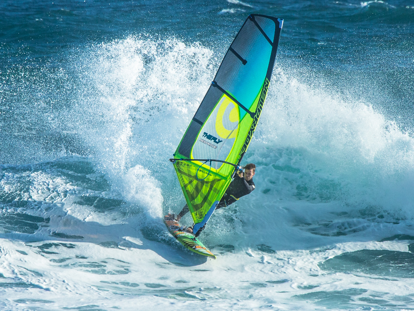
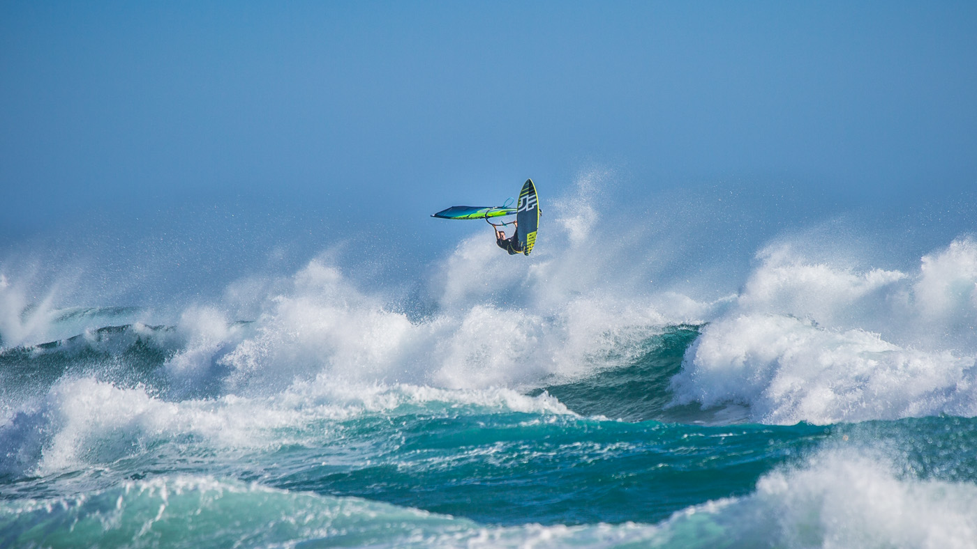
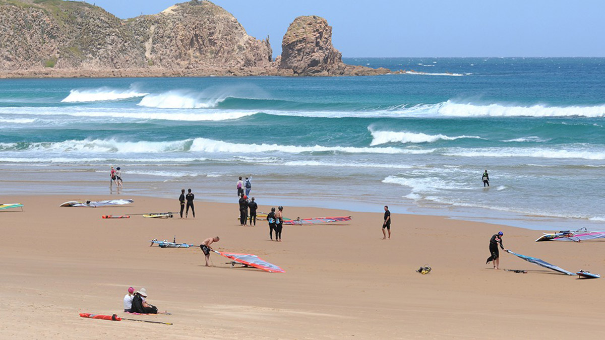
Above & Below: Great summer session at Woolamai, 3-4ft waves, 20-25 knots ESE.
Key Stats:
Wind Direction:
Works on a range of wind directions, cross shore in SE and NW wind. Best conditions are E-SE summer patterns where Cape Woolamai reduces the wind swell fetch, keeping surface conditions smooth. N-NW is choppier but can still be good, more northerly wind directions being further offshore and gustier, but with smoother waves.
Swell:
An absolute swell magnet, if there are no waves at Woolamai then it is probably flat everywhere. A 3ft swell forecast generally will mean sets over 2m. Above 5-6ft Woolamai becomes challenging and often pointless to ride with 4m + close out barrels breaking across all of the outer sand banks making conditions dangerous and easy to destroy gear. The sweet spot for advanced riders is 4-5ft, and at 1-3ft it is playful for experts and a good challenge for intermediates.
Refer to notes on wave height.
Tide:
It is important to match the tide with the swell size. A good general rule is that smaller swells prefer lower tides, as a high tide can drown small swells making the wave barely break. With a proper swell, size tends to increase on incoming tides with mid to high tides being best. Watch the shore break on high tide.
Rider Level:
Woolamai requires strong wave gear as the powerful waves can easily shred sails and snap masts especially on lower tides and solid swells. Competence with navigating the rip channels and breaking waves in low wind conditions is important as the wind can be gusty on the inside. A larger volume board can help. A strong flat water sailor can easily be punished at Woolamai, so unless you are experienced in waves, stick to sub 3ft days with strong wind forecasts.
Hazards:
For any experienced wavesailor or surfer, the hazards at Woolamai are obvious and are manageable. For the inexperienced, Woolamai regularly claims lives. Educate yourself on the rips and do not underestimate the power of the waves. If surfers are concentrated on a particular bank, choose another and avoid windsurfing in the dedicated swimming area set up by lifeguards in summer. Steer clear of the reef and rocks to the west of ANZACs carpark, sometimes the sand will form with the wave ending right on the rocks.
- Rips & Currents
- Large, Powerful Waves
- Rocks & Reef
- Surfers
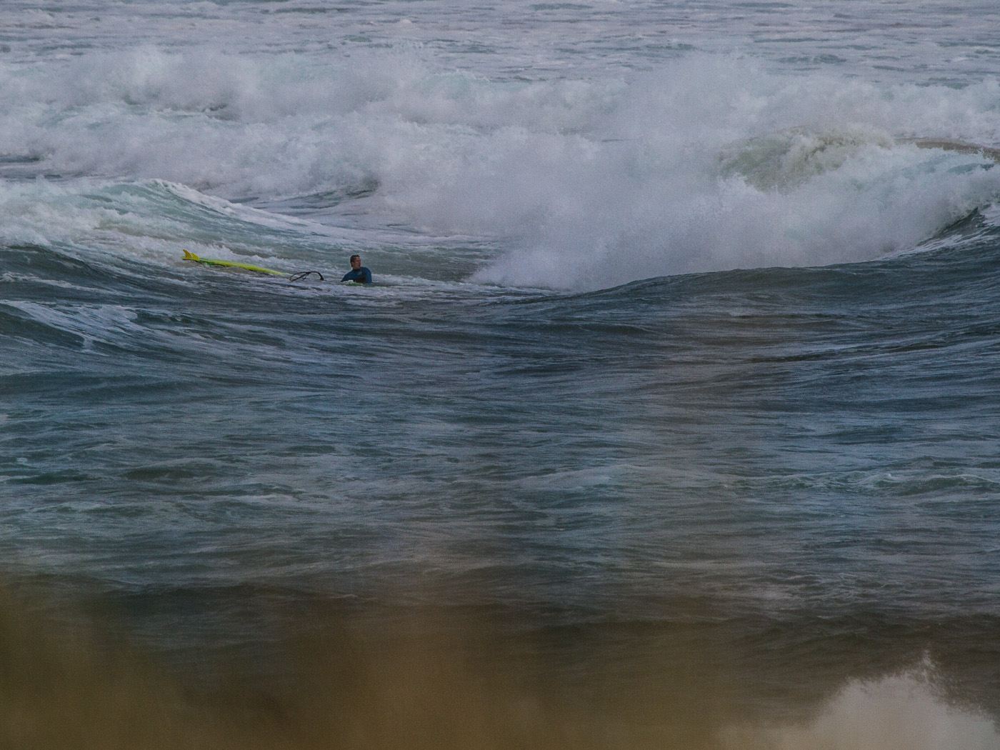
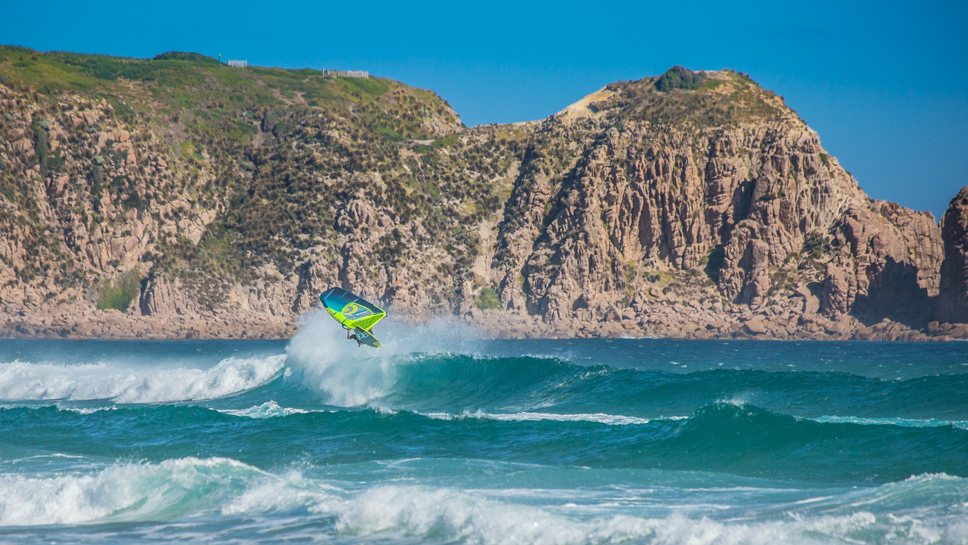
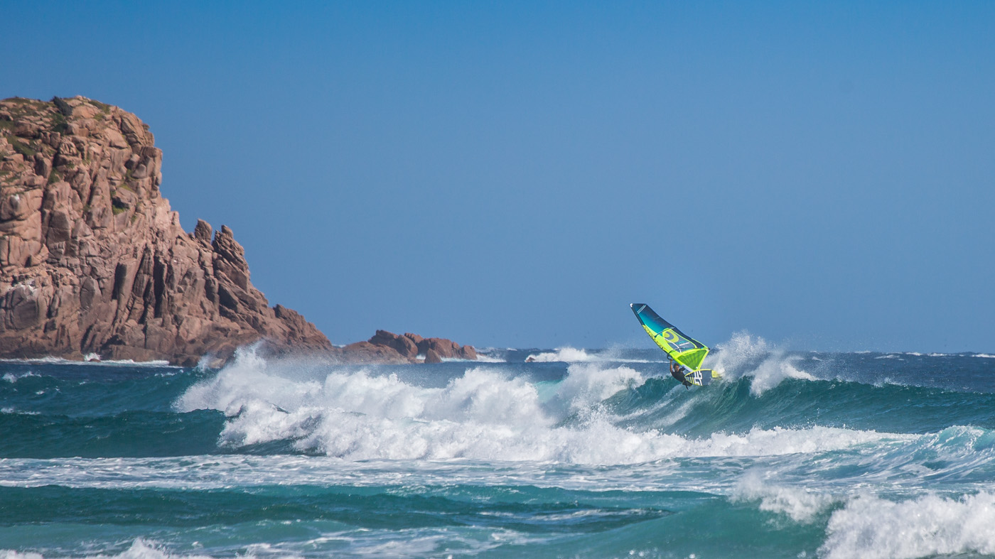
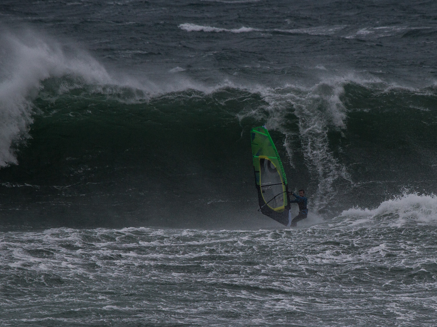
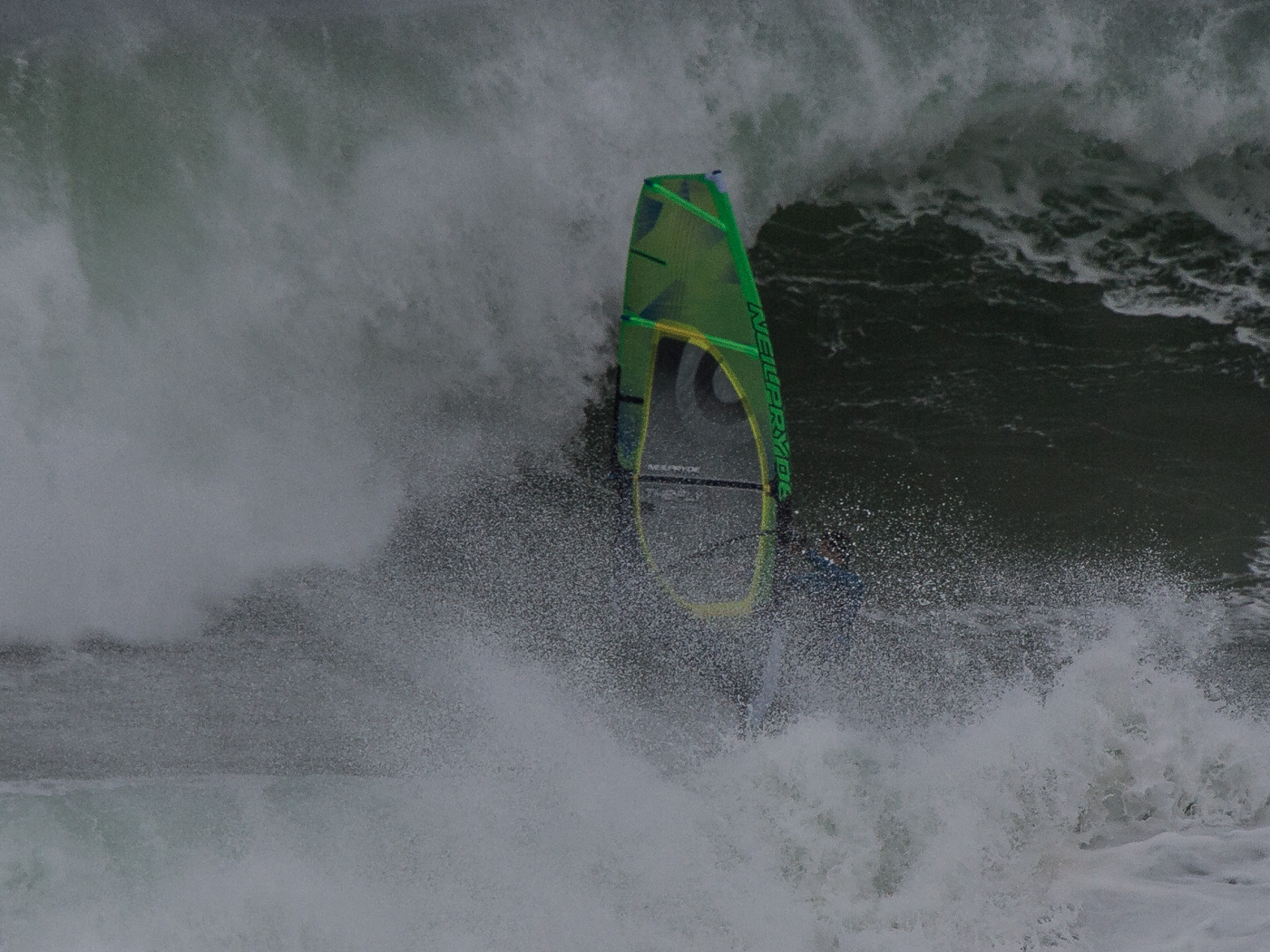
Above: Big sets and gusty wind on the inside makes getting caught in bad spots a common occurrence at Woolamai. Tackling the waves on 4-6ft+ days requires fast waterstarting in light wind and being able to punch over large whitewater with little board speed. Long punishing swims and broken gear are common at this size.
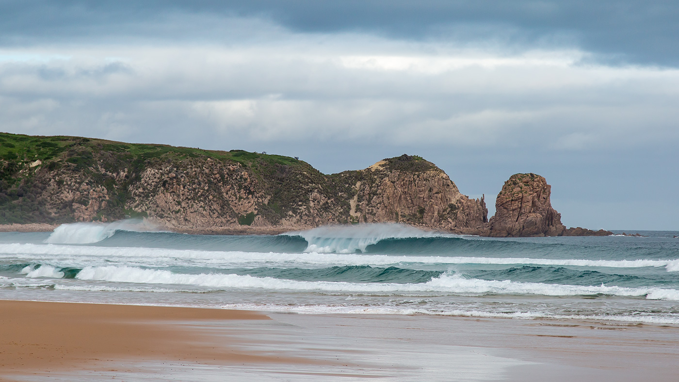
Above: Lineup shots.
1. Cloudy E-SE session, less wind than forecast but well formed 4ft waves up and down the whole beach on mid tide.
2. A classic summer small swell day with good ESE wind, about as friendly as Woolamai ever gets.
Above: Woolamai can be used as a backup spot when Flynns Reef is too small or too windy like this day where Flynns was 40+ knots. Woolamai was a 6-8ft washing machine, with very heavy closeout sets. An adrenaline rush, but dangerous and not recommended.
Forecasting Resources:
Woolamai will tend to receive summer E-SE breezes later in the day than Sandy Point and Inverloch, and earlier than Gunnamatta. In winter a strong N wind on Port Phillip Bay will often be NNW at Phillip Island.
Cloudy or cool E-SE forecasts are unreliable, often on these days Sandy Point is reliably windy while at Phillip Island the wind line will sit offshore and not fill in properly. On a classic warm E-SE pattern the wind should be in around midday, peaking at 2-3pm and slowly easing off into the evening.
Current Swell:
Check the swell forecast on Swellnet here, note that the Mornington Peninsula forecast is for the open beaches which receive the same swell as Woolamai, while the Phillip Island forecast on Swellnet is for Surfies Point and will be slightly smaller.
Check live readings from Pt Nepean Swell Buoy here. 1m average swell height usually translates to 2-4ft waves depending on period and 2m average swell height means regular 5-6ft waves (almost mast high).
Current Wind:
There are no live readings close to Woolamai, refer to Pound Creek, Rhyll and Cerberus to estimate wind strength and direction.
Rhyll is the closest location to Woolamai, but Pound Creek is further east and will show a building summer E-SE breeze sooner. Rhyll and Cerberus generally understate wind strength and are more useful for understanding direction.
Nearest Windguru Forecast:
Location:
Related Posts:
Whales & Woolamai Gold
Whales, good waves and nice wind make for a beautiful winter's session on Phillip Island. Tim from SHQ and I [...]
Summertime Play
Late Feb and March are my favourite times to hang around Victoria. Frequent world class wavesailing can be had on [...]

Social Wavesailing Days
It was decided to make the most of a solid forecast lining up across a weekend in early January. With [...]
Notes:
Swell Size:
Waves heights given in feet are ‘surfers’ size or Hawaiian Scale. Loosely this means a 3ft wave is head high, 4ft is overhead and 6ft is double overhead or mast high. Use the table below to roughly translate between surf forecasts and live swell readings at Point Nepean.
| Wave Size | Swellnet Forecast (Mornington Peninsula) | Point Nepean Swell Buoy (average height) |
|---|---|---|
| Small | 1-3ft | 0.3-0.9m |
| Medium | 3-5ft | 0.9-1.3m |
| Large | 4-6ft | 1.2-2m |
| Very Large | 6ft+ | 2.0m+ |
Swell period relates to the amount of energy in the swell, a sub 10 second period is low and will be weak. An average quality swell will be around 12-14 seconds and high period, high energy swells are typically over 15 seconds. Higher period swells will generally wrap further into more sheltered locations and lead to increased wave heights.
Disclaimer:
All information published here is for educational purposes only with no warranty, express or implied. In no event will any form of liability be accepted as the result of your use of information published on this site. You are responsible for your own safety in the ocean, educate yourself, maintain high levels of fitness, maintain your equipment and always act within your limits.
Photos:
Photos by Alastair McLeod, Olivia Hughes | untracked.media & Mark Sedgman